Omaha sits at roughly 1,060 feet above sea level, draped over loess-capped bluffs that drop sharply into the Missouri River floodplain. That contrast—between windblown silt on the uplands and alluvial sand and clay in the valley—shapes every foundation decision east of 72nd Street and west of the river. The Standard Penetration Test (SPT) remains the workhorse for quantifying that variability: a split-spoon sampler driven 18 inches into the borehole, counting blows per 6-inch increment, per ASTM D1586. In our experience, N-values in the Peorian loess can swing from 4 to 28 within a single 10-foot run, which makes blanket foundation assumptions dangerous. We run SPT borings alongside CPT soundings when the site straddles the bluff line and the stratigraphy demands a continuous strength profile.
The N-value is only as good as the energy calibration behind it—uncorrected blow counts in Omaha's stiff glacial till can overestimate bearing capacity by 30%.
Methodology and scope
Local considerations
A 6-story mixed-use project near the Old Market encountered N-values below 6 in saturated alluvial sand at 22 feet, right at the proposed pile tip elevation. The boring log showed a 4-foot lens of loose, clean sand sandwiched between stiff clay layers—classic Missouri River channel fill. Without the SPT data, the structural engineer would have designed for end-bearing on a stratum that could densify and settle under cyclic loading. We extended two borings another 30 feet, located a dense glacial till with N60 above 35, and the pile design shifted to socketed H-piles. In Omaha's floodplain, missing a loose lens by even a foot can trigger differential settlements that crack masonry within the first freeze-thaw cycle.
Explanatory video
Applicable standards
ASTM D1586-18: Standard Test Method for Standard Penetration Test (SPT), ASTM D2487-17: Unified Soil Classification System, ASTM D4633-16: Energy Measurement for SPT, IBC 2021 Section 1803: Geotechnical Investigations, Omaha Municipal Code Chapter 35 – Building and Construction
Associated technical services
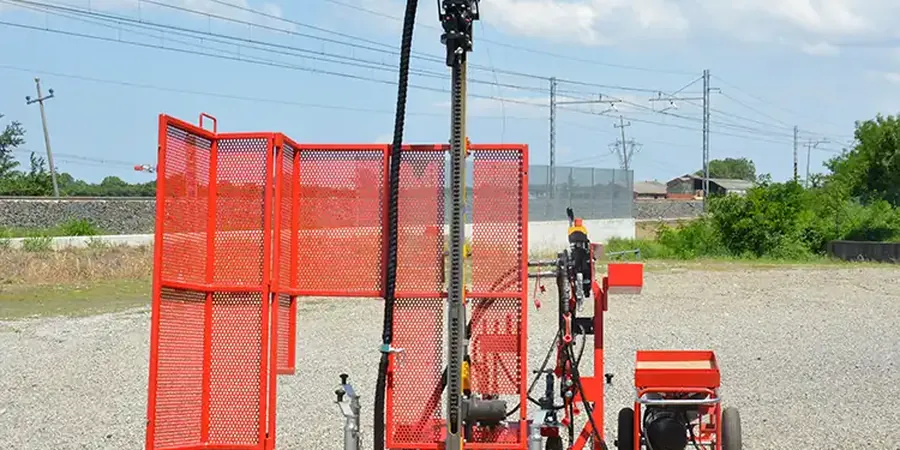
SPT with Hollow-Stem Auger Drilling
The default for sites on the loess uplands west of downtown. We advance 6-1/4 or 8-1/4 inch hollow-stem augers, perform SPT at 5-foot intervals, and collect disturbed samples for lab index testing. This setup works well in the stiff, low-plasticity loess and the underlying Loveland loess and till, typically reaching 40 to 60 feet before refusal.
Mud-Rotary SPT for Deep Floodplain Profiles
For projects east of Carter Lake or along the Missouri River levees, where the water table sits at 8 to 12 feet and the alluvial sequence can run 80 feet deep. Bentonite-based drilling mud stabilizes the borehole through loose sands and soft clays; SPT is performed every 2.5 feet in the upper 30 feet to catch thin compressible lenses. Liquefaction potential is evaluated using the Youd-Idriss (2001) framework.
Typical parameters
Frequently asked questions
How deep do SPT borings need to go for a typical 3-story building in Omaha?
Per IBC 1803.5.5, borings must extend through all unsuitable material and at least to a depth where the stress increase from the foundation is less than 10% of the existing effective stress. For a 3-story structure on spread footings in the loess uplands, that usually means 25 to 35 feet. On the floodplain, where loose alluvium is common, we often go 50 to 60 feet to confirm the top of the glacial till or bedrock.
What is the typical cost range for an SPT boring program in the Omaha area?
For a standard investigation with two to four borings to 40 feet, including mobilization, drilling, SPT logging, and a signed geotechnical report, the range is typically US$560 to US$700 per boring. Deeper borings, mud-rotary work, or sites with difficult access east of the Missouri River will push toward the upper end.
Do you need SPT data for a residential retaining wall under 4 feet high?
Omaha Municipal Code exempts retaining walls under 4 feet from engineered foundation requirements, but we still recommend at least one hand-augered SPT boring if the wall supports a surcharge like a driveway or if it sits near the bluff crest. The loess can lose strength dramatically when wet, and a shallow failure behind the wall is cheaper to prevent than to repair.
How quickly can you deliver the SPT boring logs and report?
Field work for a standard 2-boring program is usually completed in a single day. We provide preliminary N-value logs within 48 hours so the structural engineer can start foundation sizing. The final stamped report, including lab results for moisture content, Atterberg limits, and grain-size analysis on selected samples, is delivered in five to seven business days.